Dataset Setup
This tutorial walks through the process of labeling the TIFF dataset. The tutorial assumes the TIFF dataset is already extracted from Google Earth Engine.
⚠️ If you are running the labeling script: Activate the Conda virtual enviromnent!
Dataset Location in Project Repo
How to set up dataset for labeling
TREE
.
├── example_dataset
│   ├── full_img
│   └── label_img
├── README.md
├── requirements.txt
├── src
│   ├── checkpoint_data
│   ├── __pycache__
│   └── run_annotation.py
├── testing_data
│   ├── checkpoints
│   ├── data_loader.ipynb
│   ├── full_img
│   └── label_img
└── tests
    ├── polygon_mask_test.pickle
    ├── test_config.yml
    └── test_run_annotation.py
testing_data is the offical format for a (labeled) dataset
Example_dataset will be our example for this tutorial
Dataset Configuration
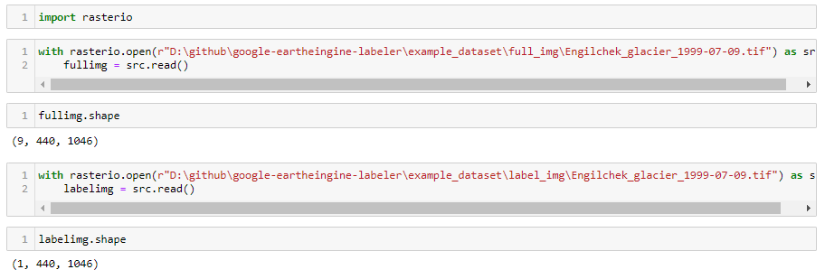
./example_dataset
├── full_img
│   ├── Engilchek_glacier_1999-07-09.tif
│   ├── Engilchek_glacier_1999-08-10.tif
│   ├── Engilchek_glacier_1999-08-26.tif
│   └── Engilchek_glacier_1999-10-13.tif
└── label_img
    ├── Engilchek_glacier_1999-07-09.tif
    ├── Engilchek_glacier_1999-08-10.tif
    ├── Engilchek_glacier_1999-08-26.tif
    └── Engilchek_glacier_1999-10-13.tif
⚠️ The full_img file name must be the same as the ones label_img
tip
| subdirectory | description |
|---|---|
| full_img | This subdirectory is where the TIFF image file with ALL the bands are present |
| label_img | This subdirectory is where the TIFF image files that will be used to label (only consist of a few bands) are present |